Bridge Clearance, Tunnels and Signs
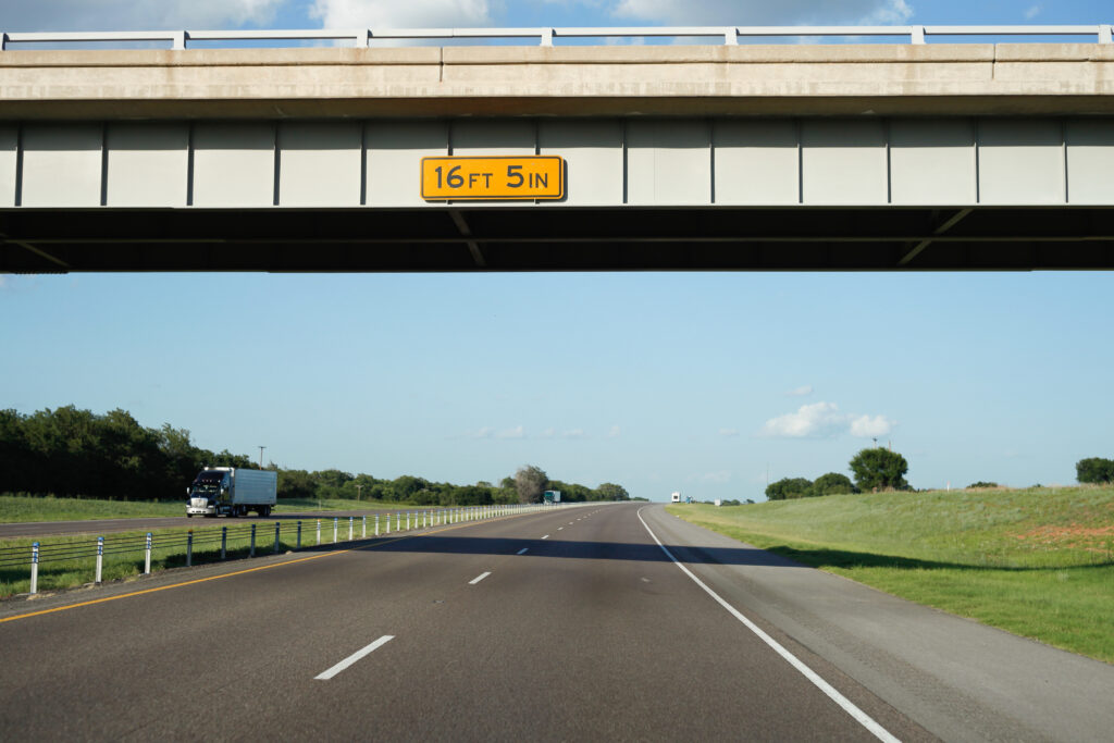
15,000 bridge strikes a year*.
* Source: data from the National Highway Traffic Safety Administration (2021)
DMP scans bridges and tunnels at highway speed with 3 mm LiDAR precision.
No lane closures, no crew on live roads.
Delivered in SNBI-ready formats.
The challenge
After every resurfacing project, clearance is reduced by inches. The database remains unchanged.
Our solution
Highway speed.
3 mm precision.
No crew in traffic.
DMP’s mobile LiDAR platform collects vertical clearance data at full highway speed — no lane closures, no traffic impact. For over 10 years, we have captured the road network in North America with unmatched precision, totaling 975,000 miles as of today.
Ground-truth LiDAR scanning
at scale
Our fleet-operated scanning vehicles capture precise point clouds, 360° overlay imagery, and full measurement data for every bridge, tunnel, sign structure, and overhead obstacle. Already deployed in 48 US states and coast-to-coast in Canada. Not a pilot, a production system.
| Precision | 3 mm LiDAR |
| Image definition | 72 Megapixels / 360 deg |
| Points Density | ~1,000 points / m2 |
| Format | JPG w/ time sync |
SNBI-compliant data output
Data maps directly to the Specification for the National Bridge Inventory fields for minimum and maximum vertical clearance. Import-ready for NBI reporting with no manual transcription.
Advanced browsing platform
Full integration with platforms like ESRI, Jakarto, Cintoo. Our data, your tools, your workflows.
Solution comparison
Capturing bridge heights is challenging. We have a solution for you.
Side-by-side comparison of DMP’s LiDAR platform versus conventional fiberglass-rod field survey methods.
| Factor | Traditional Survey | DMP Solution |
| Crew on live roads | Required, unsafe and costly | Not required |
| Lane closures | Required, with traffic impact | Not required |
| Survey speed | Hours per structure | At highway speed |
| Measurement precision and location data | Low precision, often no data on where the measurement has been taken | High precision LiDAR and location data |
| Data collection | Complex | Automated & formatted |
ITS America 2026 Detroit
Meet our team at ITS America
ITS America Conference & Expo 2026 is the ideal setting to see DMP’s vertical clearance solution live. We’re demonstrating with Wyoming DOT — a real state, real data, real compliance story.
It’s not just about bridges
If it’s on a road and it has a dimension, we can measure it. And we probably already have.
DMP’s can scan: Bridges, Overpasses, Tunnels, Signs, Gantries, Automatic Toll Collections, Electronic Logging Devices
DMP road infrastructure coverage table — 61 states and provinces across the U.S. and Canada, with counts of overhead signs, tunnels, bridges, stop lights, and mapped miles.
|
Country ⇅
|
State / province ↑
|
Overhead signs ⇅
|
Tunnels ⇅
|
Bridges & overpasses ⇅
|
Stop lights ⇅
|
Mapped miles ⇅
|
|---|---|---|---|---|---|---|
| Total — all 61 locations | 83,317 | 2,019 | 248,536 | 9,328 | 972,146 | |
No matching locations found.